
Build Up, Not Out
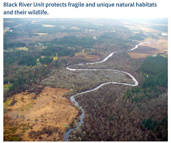
Photo By Jean Takekawa/USFWS
Black Lake Quarry Rezone: How Decades of Safeguards Were Set Aside in an Instant
Read the news article here: Growth Board Showdown: Bird Alliance vs. Thurston County Over Quarry Rezone
The Thurston County Board of County Commissioners voted 4-1 on December 16, 2025, to approve a controversial rezone of 270 acres next to fragile salmon rearing grounds at the Black River National Wildlife Refuge. Commissioner Emily Clouse was the only one to vote for protection of the National Wildlife Refuge.
As shown by the map below, the 270 acres is surrounded by the wildlife refuge.

Because this rezone endangers the refuge, the South Sound Bird Alliance (fka Black Hills Audubon Society) appealed the rezone to the Growth Management Hearings Board. The SSBA's reply brief and the attached exhibits are useful if you want to understand the legal issues in detail.
You can watch the July 8, 2026 appeal hearing here. The case will be decided in August.
If you want to see more of the briefing, you can go to the ELUHO Case Management System after you create a login. The case number is 26-2-0013. (Note that the Growth Management Hearings Board consolidated (i.e., combined) the SSBA's appeal with a different appeal by the growth management watchdog, Futurewise. Although the two appeals are now in the same case, the issues are unrelated between the two appeals.)
Barring a successful appeal outcome, the rezone puts to an end the long-held expectation that once mining was done, the site would be restored to habitat. Instead, that end state now includes impervious surface expansion, contaminated stormwater pathways, and chemical handling risks that threaten the refuge’s rare groundwater-dependent wetlands and riparian systems.
With the exception of Commissioner Clouse, the Board's focus was on near-term impacts rather than long-term impacts. Only Commissioner Clouse listened to the citizen-scientists of the South Sound Bird Alliance and took their rigorous research to heart.
You can watch the commissioners start deliberating at 3:02:30: December 16, 2025 - Thurston County Board of County Commissioners Regular Meeting. You can watch the public comment starting at 23:04.
The four who voted against protecting the National Wildlife Refuge didn’t address the elephant in the room: the mine owner's existing reclamation plan under pre-existing zoning required him to plant 700 shrubs and trees per acre when he finished mining, and that requirement is now gone due to the Board's vote. Instead, he'll only have to make the land suitable for warehouses and parking lots.
By law, reclamation after the mining ends is tied to the zoning. The nature of the reclamation matches the nature of the zoning. It restores it to natural habitat if the zoning includes natural habitat. It restores it to a few bushes if the zoning is warehouses and parking lots. Thus, the zoning determines the future of the national wildlife refuge—future as in seven generations, not future as in 10 years.
The four commissioners also were silent regarding the fact that their vote enriches the mine owner at the public’s expense. They also did not address the fact that the vote will result in degradation of treaty-protected salmon runs.
🔎 Why this matters
The Black Lake Quarry (fka Quality Rock Mine) sits beside the Black River National Wildlife Refuge, which feeds into Black Lake. It's one of the last intact riparian wetland systems in the Puget Sound region. Because of this, dozens of community members and organizations have been fighting to protect the refuge and its crucial salmon habitat from the mine's damaging effects:
-
Futurewise litigated to secure protective zoning, including 1/20
-
South Sound Bird Alliance litigated for years to block industrial plants at the mine
-
The late Sue Danver worked for over 20 years to ensure the mine’s impacts were properly reviewed
This history reflects a shared expectation: that when mining ends, the land will be restored to natural habitat.

Photo By/Credit Ryan Munes/USFWS
⚠️ What went wrong on December 2
At the Board’s agenda-setting meeting, Commissioners advanced the rezone based on statements that:
-
did not match the mine’s official DNR reclamation plan,
-
contradicted the Planning Commission’s September 3rd briefing on what a reclaimed mine looks like,
-
contradicted Washington’s reclamation law, which requires restoring mined land to a stable, vegetated condition suitable for future habitat and public use (WAC 332-18-010(4)); and
-
conflicted with findings in the Industrial Lands Study that show Thurston County already has enough industrial land.
Another major point of confusion on December 2 was the claim that Black Lake Quarry is “not regulated” under Thurston County’s environmental laws because it is an old mine, and that rezoning would newly subject it to those protections.
This is factually incorrect. The mine’s operating permit was updated in recent years, which means it is subject to today’s environmental requirements, including critical aquifer recharge protections. And even if the permit were older, Washington law does not exempt legacy mines from environmental regulation; they must comply with current law whenever impacts occur or when any permit is modified.
Rezoning does not increase environmental oversight. While a Special Use Permit may still be required, rezoning to RRI fundamentally weakens it — shifting the review from whether expanded mining is appropriate at all to how it will operate, reducing public notice, narrowing environmental and hydrologic review, and limiting the County’s ability to require or enforce meaningful mitigation.
Another misconception raised on December 2 was that approving the rezone would stop the mine from digging deeper into the aquifer. It will not. Mining continues under either zoning.
The real change is oversight: under current RR 1/20 zoning, expanded mining requires a highly discretionary Special Use Permit with robust environmental review and public process; under RRI zoning, mining remains subject to a Special Use Permit, but the review is substantially narrower and easier to obtain, greatly reducing meaningful oversight.
Rezoning doesn’t stop mining — it weakens oversight.
The rezone does not reduce aquifer risk — it increases it by weakening the County’s ability to review, condition, or limit further extraction in a Critical Aquifer Recharge Area.
Staff also asserted on December 2 that the rezone would result in “better conservation outcomes.” The record shows the opposite. Under current RR 1/20 zoning, the mine must eventually be reclaimed to a natural, vegetated condition consistent with rural land use.
By contrast, rezoning to RRI eliminates that restoration path entirely and replaces it with a type of reclamation that simply makes the land ready for long-term industrial development. Locking in an industrial end state beside a National Wildlife Refuge is not a conservation outcome.
Additionally, the County is also changing the development code so that the industrial use here could be meat processing at some point in the future. Meat and poultry processing facilities are the largest industrial point source of nitrogen pollution discharged to waterways, according to 2015 EPA data.
There was also a suggestion on December 2 that the Planning Commission’s September 3 analysis no longer applies because the applicant promised he would remove the most environmentally sensitive 24 acres from the rezone request. But that promise was never fulfilled. are not buildable anyway because they are critical areas in the wetland. This removal did nothing to alter the fundamental issues identified by the Planning Commission. The rezone still turns approximately 270 acres to industrial use beside a National Wildlife Refuge — the impacts remain the same.
Now that the Board adopted the Comprehensive Plan on December 16, this deeply flawed rezone has become permanent. The land will never again be restored to natural habitat or public use. Instead, when mining ends, the site will transition to warehouses and parking lots — directly beside one of the last intact riparian wetland systems in the Puget Sound region.
This shift saves the mine owner millions. It costs the public far more.

Adding unneeded industrial land next to a national wildlife refuge cannot be justified.
Photo By/Credit William O. Vogel
On December 2 and December 15, some of the County Commissioners justified their decision to rezone by stating that they are helping farmers have places in Thurston County to take their products for processing. They mentioned that most of the processing facilities are in Lewis County.
But Lewis County more processing facilities because it has many more farms. Adding more RRI land in Thurston County will not change the economics for an agricultural processing facility that needs to have enough farmers around it to succeed.
The Commissioners cited the Industrial Lands Report for their assertion that we need more RRI land in Thurston County. But the ILR did not state that there was a lack of RRI land in the county. What it did say was that RRI land has locational constraints and is therefore hard to site. That was based on the fact that the development code did not allow land to be zoned RRI unless it was near I-5.
Notably, the Commissioners removed those locational constraints on December 16 when they voted to approve the rezone. Therefore, the justification to approve the Black Lake Quarry rezone was eliminated at the same time the Board approved the rezone. The Board was not aware of this, however.
The mistake the Board made is due in large part to the county allowing developers to seek rezones during ten-year Comprehensive Plan update years. Many cities and counties in this state do not allow this and make developers wait until the next year, when staff have time to really look closely at their rezone proposal.
In this case, staff and the Commissioners were distracted by the massive Comprehensive Plan update and did not have time to give it the attention it deserves. Commissioner Menser asked the Board on December 16 whether the Board felt like it had spent enough time on the rezone proposal to make an informed decision. Commissioners felt like they had. They were overconfident.
Below are the locational constraints for RRI zones that the Board removed on December 16, without even realizing it eliminated their main justification for approving the Black Lake Quarry rezone.

Hopefully someday Thurston County will go the way of other jurisdictions and prohibit developers from bringing their rezone proposals to the county for approval during the ten-year Comprehensive Plan update years.
In the meantime, appellants will attempt to reverse the mistake the Board made this time around.
The mine has been subject to multiple appeals over the decades. Several years ago, (as summarized at paragraph 31 here) the prior owner of the mine applied for a Special Use Permit (SUP) to greatly expand the mine. The Hearing Examiner initially granted the permit, but local residents appealed—and the then-Board rightly reversed that decision.
The then-Board found a hydraulic connection between the groundwater on site and the water-quality-impaired Black River, an important tributary to the Chehalis River. After that, the mine owner kept trying to get a permit to expand and eventually succeeded. So the mine is now much larger (hundreds of acres).
The pattern at this mine is that every time residents succeed in stopping the mine from doing damage to the refuge, the mine owner simply tries again in the future. Persistence pays off, unfortunately.